The Mystery Island

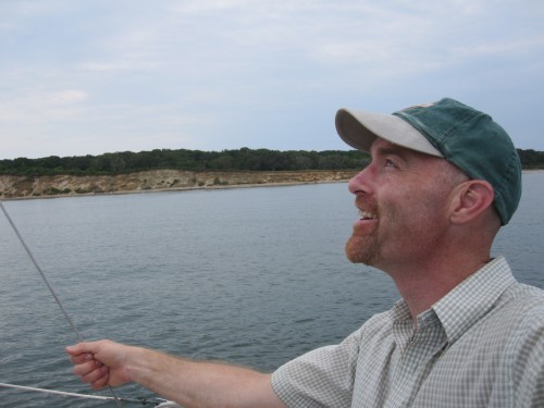
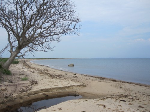
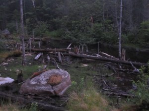
On my way to Montauk, across the Long Island Sound, the good ship Mackai with Captain Matthew came across the old man’s island. This island fair and wild it seemed, is circled with Do Not Set Foot signs in the greeting sand. From anchor-where, a gentle rising slope from west to east did meet our view. The trees clung like painted lichen on old train model sets.

The wind seemed to blow everthing to that left, as we looked south. Some rocks, over there, to the end, where he pointed, are dark of promise. Mussels? Dinner? Shall we see?

Off on the dinghy we go, a-buzz like buccaneers to the cove. To find some merian treasure. And the wind kept blowing. And the signs kept stating. Do Not.

[here is a photo-essay of our little jaunt. Enjoy]

Back on the rigger, a’sailing points bigger, leaving this sandbar, go a bit more far.

Thoughts on my mind: where else is such an uninhabited island along the East Coast? Where else such pygmy deer so un-shy? How does a family maintain a singleness of ownership since colonial times? How will they handle the rising sea? We saw the small pond breached, the cliffs falling, such trees cast down by wind to the beach. Is there a way to hold on against the sea? Our incursion was minimal and benign. Irene and her ilk, angels of Gaia, will have other intentions…


Professional Excursion

I just got back from a great retreat weekend with my new Environmental Leadership Program (New England) class of 2011 Fellows. Great time. Take a look at my entry at the main GreyLee.net

Mt. Cardigan, NH

It was May Day and my crew celebrated by getting out of town, up into the mountains. As an early season escapade, we decided to take a shorter, gentler hike. Gotta watch out for these old knees. Luckily, on Cardigan, you can get a scramble in without too much elevation gain and still enjoy fabulous tree-free views from a rocky top. It’s kinda like the “other Mt. Monadnok…”

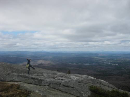
Mt. Moosilauke in the distance to the NW (right center of this pic) obscured by clouds. On the drive up, you get off I-93 and Head west on Rt. 4 to Canaan, then back east past the Speedway there, to Cardigan State Park. We were there before the last mile or so of access road is open, and parked with a few other cars on an odd little pull-off. It felt great to get up and at it. It had stared to sprinkle on the drive, and the clouds were ominous. The rain held off though, and as you’ll see, the clouds decided to give up.Great views to the west toward Vermont, Mt. Ascutney is at the left margin of this picture.

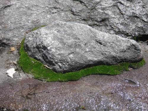
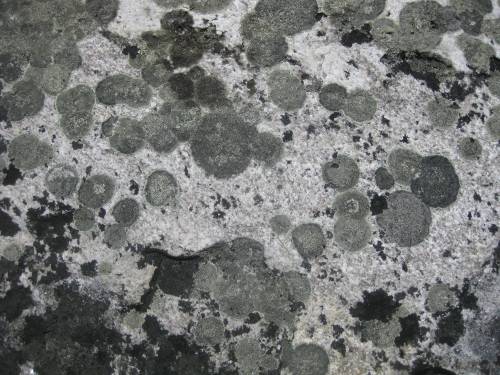
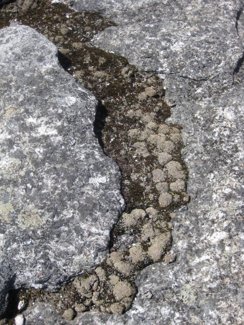
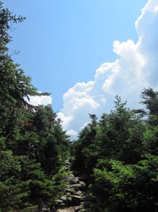
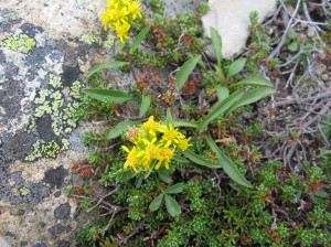
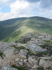
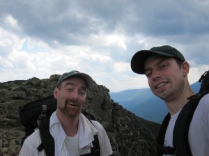
The top was too windy for lunch, so we set down a bit on the south slope and found a nice place to make PB&J’s, and devour all sorts of snackity snacks like gorp, cheese, apples, and…a few easter eggs! A couple from Montreal had been couchsurfing at my cooperative over the Easter weekend and made a ton of really nicely decorated eggs using wax to modulate the dying process. Very cool. Tasty on a mountain top.Very cool examples of plant succession on the top of the mountain. Cardigan had burned in 1855 during the sheep-boom deforestation orgy in New England. Though the mountain is only 3,121 ft tall, the forest has not come back because of the fire, which destroyed the biota holding the precious soil onto the quartz monzonite bedrock, and it will still be a long time before the trees return. The rock needs to weather with lichens to create pockets of substrate in which soil micro-organisms can gradually populate. Pictured above is a bit of a depression in the rock which can hold water and foster that biota, and thus the moss, then grasses and forbs, then small shrubs (I think this is bearberry and blueberry) which will eventually make way for trees. The last time this mountain was this bare was after the melting of the glaciers about 15,000 years ago. It may take centuries for the cloak of the local biome to recover this site.I tried to catch the reflection of the blue-ing sky in the small puddles on the rocks in this picture, it was a neat impression. The scene looks north through the classic central New England mixed forest landscape.We started to head out as the sun came on stronger and stronger. Pete and Jeb tried to make sense of the signs.I thought this was cool…There was still a lot of snow packed onto the trail in places, but most of it had melted in the underbrush.Heres those lichens doing their thing on the bedrock. I like the patterns you find in nature.Since the sun was out, we decided to take a break on a piece of ledge to enjoy the fine-ness.In the center of the distance, you can see the trails of Ragged Mountain, a small ski resort. Further, to the right, is Mt. Kearsarge. That’s another great peak for a good dayhike, and only 2hrs from Mashauwomuk (Boston/Cambridge area). Further still, just to the right of that, invisible in this image is a windfarm we could see. I don’t know where it is, but it must be near Sunapee and that area. I always enjoy seeing windmills. However, a windmill on the top of the peak in the mid-ground of this picture would not be so great to me. Maybe there needs to be a process to identify places to encourage wind power development and where to say “how about not” to those projects. I don’t know that it is done regionally now, but considering the views and implications, it ought to be regionally organized somehow.Here I am looking at those windmills. Behind is a wind shelter made of stacked stones and in the background is the main peak of Cardigan with the fire-tower on top. Kinda looks like a perched bird in this pic.More cool lichens and mossClose up of the little biota – not sure the species, but these are two types of articulated lichen and a moss in blossom. Actually, I don’t know the name of an exploded moss spore capsule, but they look kinda like a flower.

I took about a hundred more pictures of plants on the way back dwn the mountain. I will put them in my natural history blog – where I catalog denizens of nature as I find them. At some point I hope to make that more of a resource for the public. Alternatively, I might amend this entry and then figure out ways to tag photos so people can look stuff up by tags – “BioCatalog” and whatever specimen the photo references. We shall see. Thanks for tuning in for now.

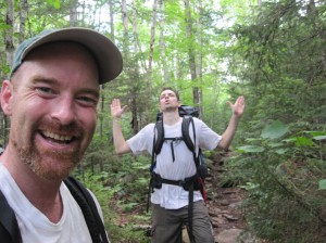
It was a great start to the hiking season. Yes this picture is from the start of the hike, but I don’t have a better one of the end of the hike of all of us. We actually spent almost an hour lounging on the grass at the bottom of the trail. It was just so nice out we just had to soak it up. And this is about a 2.5 hour round trip hike, so you don’t need to rush. Pete and I did some handstands and there was some yoga going on as well. Eventually we got going and headed out. We’ll be back!!

Into the Pemi!

[Mt. Garfield from Galehead Hut. Mt. Lafayette in the distance]

The intention originally was to mobilize a team to perform the Presidential Traverse – that awesome 18-mile one-day 9000ft elevation excursion along the ridge from Madison, across Washington to Webster.

I have done it a few times over the years. My old work colleague, Jess Roll, from back in the early days of Land’s Sake, would bring a platoon and I the other and together we would romp across those white mountain tops. I didn’t last year on account of work issues, the year prior I was with my bros in Russia, ’07 was rained out but we went up and down Madison anyway. ’06 was a great year with Ted and Benny joining. ’05 had a larger crew using a biodiesel truck to get us up and back. ’04 was a rain out. ’03 and ’02 were fine hikes.

Well, we tried in July but people bailed out – a car accident (not major), a wedding planning, too many weekends planned in a row, that sort of thing. So we scrubbed and postponed. We will be going for it again on the 20-22nd of August, don’t you worry!

At any rate, Tony was the one person still interested. He said “hey man, even if it’s not the Traverse, if you wake up with a wild hair day on Friday, I’m up for heading north.” “Let’s do it!” I said.

So, a loop in the Pemigewasset wilderness.

Here’s the trail:

I can’t remember the name of the trailhead – it’s the first major parking lot east of Lincoln NH on the Kancamagus  Highway. Got there around 7:30 and hiked for about four-five hours. Nice classic northern forest ecology.

Long steady climb along an old railbed. Stayed at 13 falls tentsite ($8/person) which only had one other party and the tender. Fine little site. Tony lost a waterbottle – flew right out of a pocket down the tumbling stream.

But we were in the Pemi Wilderness, and everything was cool. All that civilized stuff, possessions, philosophies, just sloughs off as you put one foot after the other on the climb.

Great view from Galehead Hut toward Guyot and BondThis was a strange rock formation – looked like an impact crater or something. Mystery of Nature encore…

Great day for a hike!

A bit windy on top of South Twin.

Great to be in the alpine zone

The Bondcliffs beckon

Nice Wilderness

Cool rare plants

This is what it’s all about – really getting out there, out on the trail

Not a lot of cliffs like this out there, east coast, ancient stones, all that

I’m not sure why we are looking like this here. Generally delirious?

Definitely Delirious!!!

Great hike! Great new vistas! Great teamwork on motivating, mobilizing and moving. 18 miles, new territory. Good training for the actual traverse coming up, mark your calendars now: August 21st!

Guns vs. Butter

This is from ZCommunication.org – I reposted it on my travel blog b/c I couldn’t get the link to patch to their site from fb. Feel free to scroll below to some of my travel pics and entries.

Obey’s Afghanistan: At Long Last, It’s Guns vs. Butter


By Robert Naiman
Source: Just Foreign Policy Monday, June 21, 2010

One of the many destructive legacies of the Reagan Era was the effective Washington consensus that wars and other military spending exist on their own fiscal planet. Reagan got a Dixiecrat Congress to double military spending at a time when the U.S. was not at war (unless you were a poor person in Central America.) Meanwhile, Reagan got the Dixiecrat Congress to cut domestic spending – we just couldn’t afford those costly social programs. Reagan pretended the two things were totally unrelated, and the Dixiecrat Congress went along.

Ever since, the Democratic leadership and the big Democratic constituency groups have largely collaborated in maintaining the destructive fiction that we can shovel tax dollars to war and to corporate welfare called “defense spending” without having any impact on our ability to provide quality education, health care, effective enforcement of environmental, civil rights, and worker safety laws, and other basic services to our citizens that are taken for granted by the citizens of every other industrialized country.

But maybe – maybe – that destructive connivance is coming to an end.

This week, House Appropriations Committee Chair David Obey told the White House that he was going to sit on the Administration’s request for $33 billion more for pointless killing in Afghanistan until the White House acted on House Democratic demands to unlock federal money to aid the states in averting a wave of layoffs of teachers and other public employees.

Obey didn’t just link the two issues rhetorically; he linked them with the threat of effective action.

At last, at long last.

But why is David Obey standing alone?

Perhaps, behind the scenes, the big Democratic constituency groups are pulling for Obey.

But you wouldn’t know it from any public manifestation. Why? This should be a “teachable moment,” an opportunity to mobilize the majority of America’s working families to push to redirect resources from futile wars of empire and the corporate welfare of the “base military budget” to human needs at home and abroad. Where is the public mobilization of the Democratic constituency groups?

If we could shorten the Afghanistan war by a month, that would free up the $10 billion that Obey is asking for domestic spending. Rep. Jim McGovern’s bill requiring a timetable for military redeployment from Afghanistan currently has 94 co-sponsors in the House (act here.) If McGovern’s bill became law, it would surely save the taxpayers at least $10 billion. Why aren’t the big Democratic constituency groups aggressively backing the McGovern bill, demanding that it be attached to the war supplemental?

This isn’t just a question of missing an opportunity. There is a freight train coming called “deficit reduction.” If the big Democratic constituency groups continue to sit on their hands on the issue of military spending, then we can predict what the cargo of that freight train is likely to be: cut Social Security benefits, cut Medicare benefits, raise the retirement age for Social Security and Medicare, cut domestic spending for enforcing environmental regulations and civil rights and worker safety.

Ending the war in Afghanistan with a timetable for withdrawal would likely save hundreds of billions of dollars. That’s money that could be used to prevent cuts from jobs and services at home.

And we can cut the “base military budget” – the money we are purportedly spending to prepare for wars in the future, whether those wars have any measurable probability of occurring or not – without having any impact on our security.

The Sustainable Defense Task Force – initiated by Rep. Barney Frank, Rep. Walter Jones, Rep. Ron Paul, and Sen. Ron Wyden – has modestly proposed a trillion dollars in cuts to the military budget over ten years, targeting long-derided weapons systems like F-35 Joint Strike Fighter, the Expeditionary Fighting Vehicle, and the V-22 Osprey. As Joshua Green notes in the Boston Globe, even Dick Cheney says the V-22 is “a turkey.” As the current annual military expenditure of the U.S. is roughly $660 billion, this would roughly amount to a 15% cut. Note that the U.S. is currently spending about 4.3% of its GDP on the military, more than twice what China spends as a percentage of its economy (2%.) If we cut our military spending 15%, we’d still be spending far more as a percentage of our economy (3.7%) than China, and far more than Britain (2.5%) and France (2.3%). And in absolute terms, we’d still be spending more than the next ten countries combined – most of whom are our allies. Such a cut would free $100 billion a year for deficit reduction and protecting domestic spending from cuts.

The president’s Deficit Reduction Commission will recommend a package of cuts to Congress in December for an up-or-down vote. Will the Deficit Reduction Commission recommend real cuts to military spending?

On June 26, the deficit reduction freight train may be coming to your town. The well-financedAmerica Speaks is hosting a “national town hall” discussion in twenty cities on June 26 about ways to cut the deficit, promising that they will push the result into the Washington deficit-cutting decision. Check to see if the freight train is coming to your town. If it is, why not go and see if you can stow away some military spending cuts – like ending the war and cutting the V22 – on board the train?

Tip of Summer in Vermont

Just about the beginning of May, I had a friend from Japan visit me, Atsuko. She and I went to UVM together back in the mid-90’s. She runs the philanthropy branch (more like a twig) of a large forest products firm in Japan. They sponsor some preservation and some art and education programs in Tokyo.

We decided to visit some friends in Burlington. So, back into the little red rocket I went, having just toured the great plains. Now, a weekend in the Green Mountains.

Below are some of the delightful photos from this trip.

Crossing the Connecticut River on I-89 into the Green Mountain State!

The first of many bucolic views. As soon as you enter the state, one senses something different about the place. One reason is that the mountains and landscape here is 200 million years older than the more recent geology of New Hampshire. Both states are uplands caused by volcanic and tectonic activity of long ago, and the Connecticut River is where water has found the lowest passage between the two uplands. So it really does divide two different lands.

At the rest stop in Sharon, a living machine, where human waste is processed by plants and aquatic biological communities to become safe – it turns into water vapor, carbon dioxide, and plant material which can be harvested and composted. It’s a little more complicated than that, so check this out.

The green hills along the White River.

Heading down from the ridge, toward Montpelier, that’s Mt. Mansfield in the distance.

Downtown, Burlington, along Church St across from City Hall. The street is one of many successfully pedestrianized downtown retail districts in the US. It was designed in the 1970s and implemented in the 80’s. It really serves as a public focal point for the city, anyone who’s visited Burlington is sure to have enjoyed a stroll down Church St. Back when I was a student, I would always bump into someone I knew, not so much anymore, alas…

Lunch was a Red Onion Sandwich – a classic.

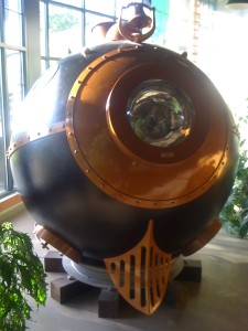
This is “The Train Ball” – a very cool sculpture.

I got in and tried to figure out how to get it to go – seems I’m not enough of a steampunk for a real adventure.

The up to the main campus – this is the Old Mill, the oldest main building of the campus, now the Geography Dept. and a couple of other things.

In the new Davis Student Center it was the tail end of the exam period and the African Drumming and Dance class had their final presentation, quite cool. This facility, LEED certified and full of great features, is an amazing gathering place and crossroads for the entire campus. When I was Student Government President, we had a committee to review what we needed as the then student center was really the basement of the old Billings Library. Many can recall that I practically lived there my senior year, and I enjoyed that – between time in my office and time at the radio station – but UVMers needed better. Though the cost was high, the value is even more, and I’m glad to see the place fit in and support a vibrant community so well.

Back down the hill to the waterfront – great view of the Adirondak Mountains on the New York side of Lake Champlain. Shelburne Point is on the left side of the horizon.

Now heading east, along Rt. 15, through Jericho. This is another view of Mt. Mansfield.

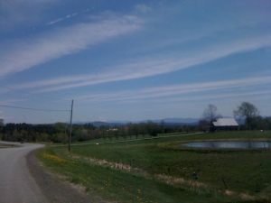
Now along the Lamoille River, just one of many delightful old farms. Possibly one of the 1000 dairy farms in Vermont where milk prices have declined by 50% since 2008. Farms with fewer than 100 cows lose $10,000 on average every month because of collusion on pricing in the industrialized milk industry.

Looking back at Mt. Mansfield, also known as “Moze-o-de-be-Wadso” by the Abenaki people of this area.

We found this neat old covered railroad bridge.

I liked the interior load-bearing latticework.

The Lamoille River, further north now, you can see how the leaves are just budding out on the hardwoods.

Now right on the way into the Northeast Kingdom of the state, with more gorgeous grazing land on either side of the state road.

Here we are just on the highland between the Lamoille and Connecticut valleys. Ahead in the distance: the White Mountains.

Here, looking out over a really dense stand of dandelions, in the distance, you can see the snow-capped peaks of the Presidential Range – the highest mountains of New Hampshire. The best of both lands, you might say.

It was a great weekend in the countryside of a special place.

I got in and tried to figure out how to get it to go

The Last Stretch

Well, I’m back in Cambridge now. It’s great to be home. It was a lot of driving.

I did it. The Great Northeastern Ride. Chicago-Boston in one day.

15.5 hours. A beautiful day. A good long ride.

Left at 4:30am Chicago time in a good rainstorm through most of Indiana.

Cleveland by 11am. Northern Ohio is a bit flatter than I expected.

Took the southern New York route – US 86 to Binghamton and US 88 to Albany. This territory was a new delight for Grey Lee. Very attractive hill country. Lots of small dairies and maybe a few other types of operations coming up in the cracks. Plenty of timber resources. Lots of small towns, some of them apparently part of the eastern extreme of the rust belt. Great rolling highway and even inspirational. Like southwestern Vermont for 250 miles. Glad I found it.

And now back. Here are some phone-photos:

Welcome to Indiana in a rain storm at 5am. Actually 6am now.

Industrial chicken farming in the heartland. How long will this continue?

I missed “Welcome to Ohio” but it was also entering this most northeasterly county of the state. Still totally farm country. Still rainy.

More conventional corn and soy country. Amazing how I’ve driven 2000 miles of pretty much uninterrupted industrial farm landscape by now. But look – the sun is starting to break through there, in the distance. A new day is dawning! The drab overcast of feedstock agriculture is coming to a close. Let the green wind blow!

Okay, now entering Pennsylvania for a few miles. I would like to know more about the idealism of this place and its interesting origins. Quakers. Brotherly love. While in Chicago I caught up with a friend of my cousin. He works with Mennonites. They have a common-purse fellowship of 45 individuals in a number of families in the neighborhood near their church in Chicago. It’s a voluntary simplicity thing. Work 20-30 hours. All income is pooled, and then communally doled out into budgets for each member household. This is really outside the ameri-medialogical norm. No health insurance – they sell one of the communally owned apartments if something bad happens to someone, believing they can manage the expense better that way, rather than feal to a health/industrial medicine profiteer. They take cooperativity to a new level. Really interesting community model.

More corn country even in PA.

Pick-up trucks are an amazing symbiote with middle-america. I have seen a lot on this road trip. I wonder what will happen if gasoline goes to $5/gal. What switches will be made? I consider other places where gasoline is an even greater portion of income. Out in the majority world, I have seen some really interesting mopeds and motorbikes tricked out with cargo platforms and trailers. A future growth segment for Harley-Davidson?

And now: the Empire State! What an amazingly proud and obnoxious statement. I suppose enough people feel like patricians and beneficiaries of the Empire that they support the motto. But isn’t every empire built on the extraction of wealth from a disadvantaged negotiation? Will that eventually be acknowledged and repudiated? Perhaps. Some fine day.

Meanwhile, I, spiteful member of the privileged Imperions, drive on. Fossil carbon for breakfast, lunch and dinner. 33mpg, not too bad, but not like my wooden zeppelin (details in some other post). And even the electrons behind this blog are 25% nuclear. But don’t let me get into that yet. Let’s suspend disbelief and continue, shall we? Cheers…

The classic New England Dairy. Well. New York. As old York is part of England, allow me the liberty of connecting New York State to New England in a broad way. It’s all northeast to me. Common colors, biota, breezes.

The silos from the 70’s are a relic of that old get big and into debt mentality from the midwest. There are other, cheaper techniques of saving biomass for the herd nowadays.

My point is that I was driving through a landscape that speaks to me of hard workers, the power of sunlight and seasonality, of partnership between man and beast. It was beautiful.

And the farms formed communities throughout these ancient river valleys – the Allegheny, Tioga, and Susquehanna. The hills keeping the farms and communities small. These mountains lack the exploitable anthracite found to the south in Pennsylvania. Even the timber industry has mostly moved on.

The land here has a familiarity to me unlike anywhere in the West. The hills have a (what is it) parabolic shape – based on a formula combining the underlying rock substrate, time, and weathering patterns of rain and snow – that is known to me intuitively. The trees are white pine, oak, hickory, some maple. A spruce here and there driving at the top of a pass. Beaver ponds with a rhythm of known shrubs, reeds and grasses. Familiar faces alongside the road.

There is an acknowledgment of the earlier human residents, before there were farmers of the european style. The Seneca nation still resides in the area. However, much of their income is from a giant casino along the side of the highway. I don’t think casinos are good businesses for communities. They take wealth away from people on the premise of hope, a passive luck-based hope rather than a hard fought small business and farm hope.

I think I’ll come back to visit this summer. Camp out somewhere. Maybe find an interesting young farmer or two to catch up with. It would be nice to see on a sunny day.

That’s enough waxing poetic. I’ll have to find some Wendell Berry this evening to carry on. Let me know if you want to take a tour out there with me this summer!

And then, Schenectady, then Albany, rattling along up into the Berkshires and I was back in Massachusetts.

Just a little later I was on the old Mass Pike going through the Lee exit where I sometimes go to Lennox for Shakespeare and Company. Familiarity rather than exploration of the road.

Before I knew it I was on auto-pilot through the Weston tolls (having passed all the water system commotion of late) and stopped off at my bro and belle-sister’s place near Davis Sq and had a beer. It was a gorgeous night. About 70F.  Rolled up to the old Coop and found a few folks on the porch hanging out. There were hugs and cheers, beers and chatter. Just right.

Good night.

Colorado to Illinois

Well, let’s see if this works. I am going to send you to Picasa on this link, hope you can enjoy the pics there.

Based on this experience of putting them together this way, I think I’ll go back to selecting fewer and writing more significant commentary here at the greygoes blog.

Let me know what you think. Thanks.

Boulder Boulder

Anu and I finally arrived at my old buddy Mike Jospe’s place in Boulder. The day was long and full of snow, but Boulder was looking delighful on the way in.

Mike went to grade school with my buddy Adam, then to another private school in New Hampshire. On the weekends and holidays, he came back to his parents’ place in Concord, MA, near Weston, and became part of the Weston Boys. He is now a psychological therapist for families with troubled teens, and does a lot of wilderness trekking/experiential therapy as well. We had miles of conversation to attend to.

These are the Flatirons you see coming into Boulder.

This is Mike and Erin’s cute little bungalow. Not quite as bungalowey as those in Oregon and California, but still not a New England Colonial!

Erin was unfortunately (for us) out of town – volunteering at an orphanage in Nepal (and trying to stay out of the political unrest). She is looking to find a role doing creativity and art-based therapy with children there, which she does in Colorado.

And this is Mike’s truck in the cute neighborhood. We walked a bit up the street and through a great well-used park to a small pub-brewery, the Southern Sun, for a snack, then went out on the town to find dinner at Sherpa – a place of a family of Tibetan sherpas. Great food. Kinda like indian.

Sherpas who have died on the mountains are commemorated here. The wait staff are also mountain guides here in the Rockies. It was a great meal and nice to walk about the Pearl St area. Much more lively than what we’d seen in Idaho Falls.

Morning brought us a big surprise! It melted off in about two hours though, which is usual there in Boulder, Mike says.

Had a great breakfast at the local neat-o diner. Anu was surprised when I switched from photographing the meal to catch her copying me.

We went to the Boulder Bookstore – a great big old shop. Seems to have been built into an old hotel or something – there was this upstairs “Ballroom” converted into the fiction section or something. I loved this space! Reminded me of reading rooms at Goodenough College and oddly enough, the state library in Moscow which also had a lot of plants.
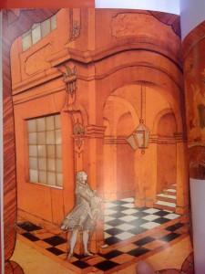
Okay, this is kinda cool. You are looking at a liquid-crystal or CRT screen of a digital photo of a page of a book of 18th-century German furniture, of an image from the surface of an old desk which is an inlaid-wood image of some old guy about to enter a fancy building. The whole three-d thing is done with varying toned types of wood and mother-of-pearl. I found this amazing! I would like to take this book and find this building in Germany somehow.

Then in the men’s room, I found this old map of Boulder, a plan really, of Fredrick Law Olmstead’s design to improve the city back in the old days.
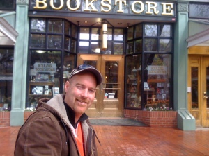
I did like this bookstore.

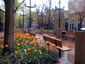
Pearl Street in Boulder is a pedestrianized mall. Love the flowers. I kinda enjoyed the brightening day while Anu went and shopped a lot.

Actually, I also did enter some of the little shops…

I didn’t actually buy a wand. Some of them were over $250. How long does the magical charge last on one of these?

I think the mannequin on the right has the same bust as the one on the left. I did like the shirt on the left a lot.
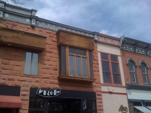
Cool facades in Boulder. Older-feeling than Portland Oregon.

Erin is giving a few presentations in a coulpe of weeks. Neat to see the flyer up around town.

Great to be with Mike in his stompin’ ground. Actually, wait until after lunch for the pics of when we really stomp around…
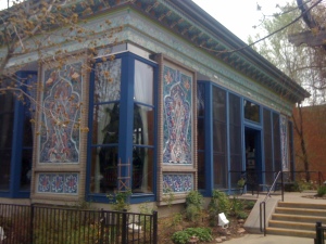
The Dushanbe Tea House – a gift from the people of Kyrgyzstan. Great central asian meal. I had a special tea – puerh – which is partially decomposed and full of great things. Like compost tea for your belly.

The whole place was handmade and then disassembled and brought over in pieces then reconstructed in Boulder. Amazing craftwork. A real gem in Boulder.

Then to walk off all the tea and food, we strolled up the Boulder Creek, through this underpass where the walker/bikers are actually below the level of the water in the spring, to head for the hills.

Delightful to be able to just walk out of town into the woods. Or at least hills, since it’s not so very woodsy.
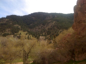
These are the Red Rocks of Boulder.

Who is this guy?

Great view looking out over the city.

Thanks for showing us this cool place, Mike!

Then we headed down the slope back into town. We got back to Mike’s and rested up a bit before heading out to dinner. Yes, we pretty much ate out for four days. But it was all good stuff. Dinner was at Ajai, a south-american inspired place downtown. The caipirinha could have been sweeter, but at least it had decent cachasa.

It was a great day and a half in Boulder. We retired back to Mike’s and chatted about the end of the world as we know it and the arrival of the earth-based society, and how we are going to help it come into being. I’m a little hopped-up on Bill McKibben’s latest, Eaarth. But more on that later.

In the morning, we went back to the same diner for another great meal. We actually had the lucky table and got a free coffeecake. A good omen for the road. Next stop, Denver!
Pete’s place in Idaho Falls

It was a rather lovely day for a drive, although this photo makes it look less pleasant. We had left Portland at about 8am (see the previous post). After the nice lunch stop, we cruised onward and got to Idaho around 3pm.

Along the Snake River now…

Here we are at the Idaho Falls! Not quite Niagara…

Getting dark, and you know how it is with the flash-less iPhone…

We found the one brewpub in Idaho Falls and had a nice dinner and visit with Peter.
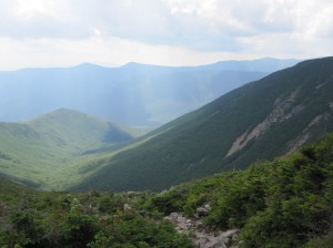
Then in the morning, we said good-bye to his little happy house, and we were on our way to Boulder!